

The Sunshine Coast Trail
Canada's longest and only free hut-to-hut hiking trail

Ahh, the Sunshine Coast. The name alone plucks at our curiosity and paints the mind with something beautiful… something special. Of course, many sun-bathed coastlines around the world could be named as such. But the sunshine along this particular stretch must be something especially wonderful, for this coast sits squarely in one of the rare rain shadows of North America’s great northwest coastal region.
Tucked behind the mountainous spine of vast, forested Vancouver Island and rising above the golden tendrils of a place called Desolation Sound, Canada’s Sunshine Coast represents the southern stretch of a vast, fjord-carved and conifer-clad coastline—the shore of one of the world’s greatest temperate maritime regions, encompassing the coasts of British Columbia and Southeast Alaska.
If you’re familiar with the vernacular of long trails, you’ll know the term “thru-hiking.” Personally, I don’t much care for the term. It originates from the distinction made between hikers completing a full end-to-end trek of a long trail versus the mere “section hikers” who only sample a piece of it. But whatever you choose to call it, Canada’s Sunshine Coast Trail is one trek that is highly accessible to those who can spare just a couple of weeks, want to complete a full end-to-end journey of more than 100 miles on a single mid-trail resupply, appreciate the novelty of a free hut system, and are looking for a lesser-known option compared to the more, let’s say, social and trendy long trails often found to the south in the United States.
The Sunshine Coast Trail is a relatively young one, founded in 1992. But based on its on-trail infrastructure and digital resources, it is exceptionally well-managed and maintained by the qathet Parks and Wilderness Society (qPAWS), a dedicated non-profit organization.
Let’s break down the logistics. The Sunshine Coast Trail is 180 kilometers (approximately 113 miles) long. Its southern terminus is Saltery Bay, its northern terminus is Sarah Point, and the main commerce and supply hub is the coastal town of Powell River. Located roughly at the trail’s midpoint, Powell River makes for a relatively easy mid-hike resupply stop. While it can be hiked in either direction, the route is traditionally designed and intended to be tackled southbound.
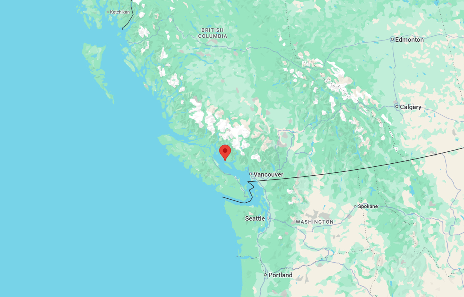
To zoom out geographically, this is in southwest British Columbia, on the mainland coast opposite the middle section of Vancouver Island. It’s a four-and-a-half-hour trip north from the city of Vancouver to the southern terminus at Saltery Bay (including a couple of scenic ferry rides). Add another hour to reach the rugged northern trailhead at Sarah Point. Local shuttle and water taxi services are readily available to get you to and from either terminus or any of the over two dozen mid-trail access points.
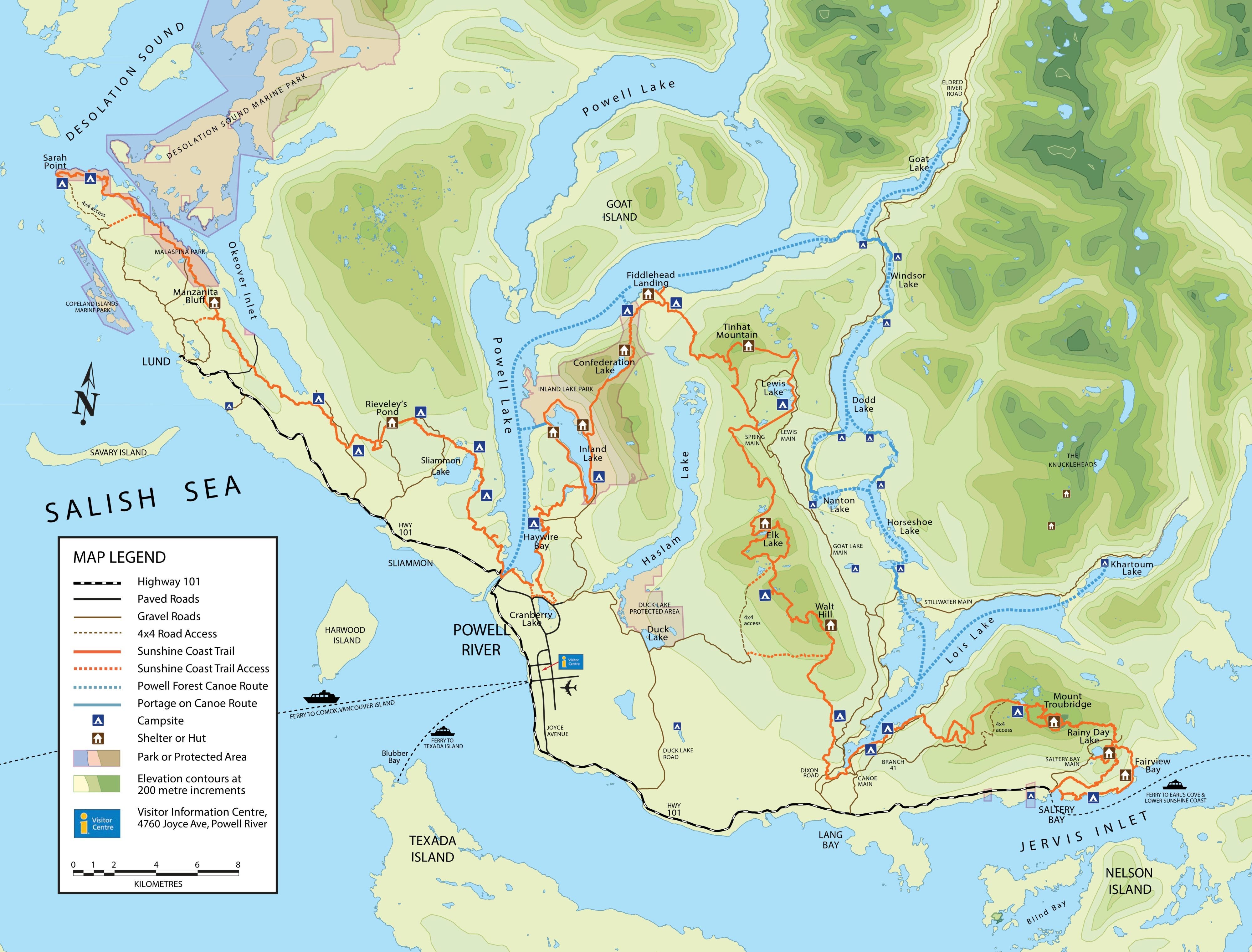
The trail itself features 14 (with a 15th planned) free, winterized huts alongside a scattering of designated tent camping sites equipped with pit toilets, picnic tables, and fire pits. All campsites and huts operate on a first-come, first-served basis, and each hut can comfortably accommodate up to 12 people. There are no permits or fees required anywhere on this trail, and leashed dogs are welcome to join you. Bear spray, however, is highly recommended.
While the infrastructure makes this trail easy to plan for, that doesn’t mean it’s a walk in the park. The stats show that this is a rugged undertaking with nearly 20,000 feet of cumulative elevation gain. That’s a comparable average gain per mile to our mountainous Colorado Trail, more than both the Pacific Crest and Continental Divide Trails, and only slightly less than the notoriously steep Appalachian Trail. The climbing comes not from epic, sustained alpine ascents, but from the repeated dips down to sea-level coastal bays followed by steep, punchy runs back into the interior mountains, peaks, and ridgelines.
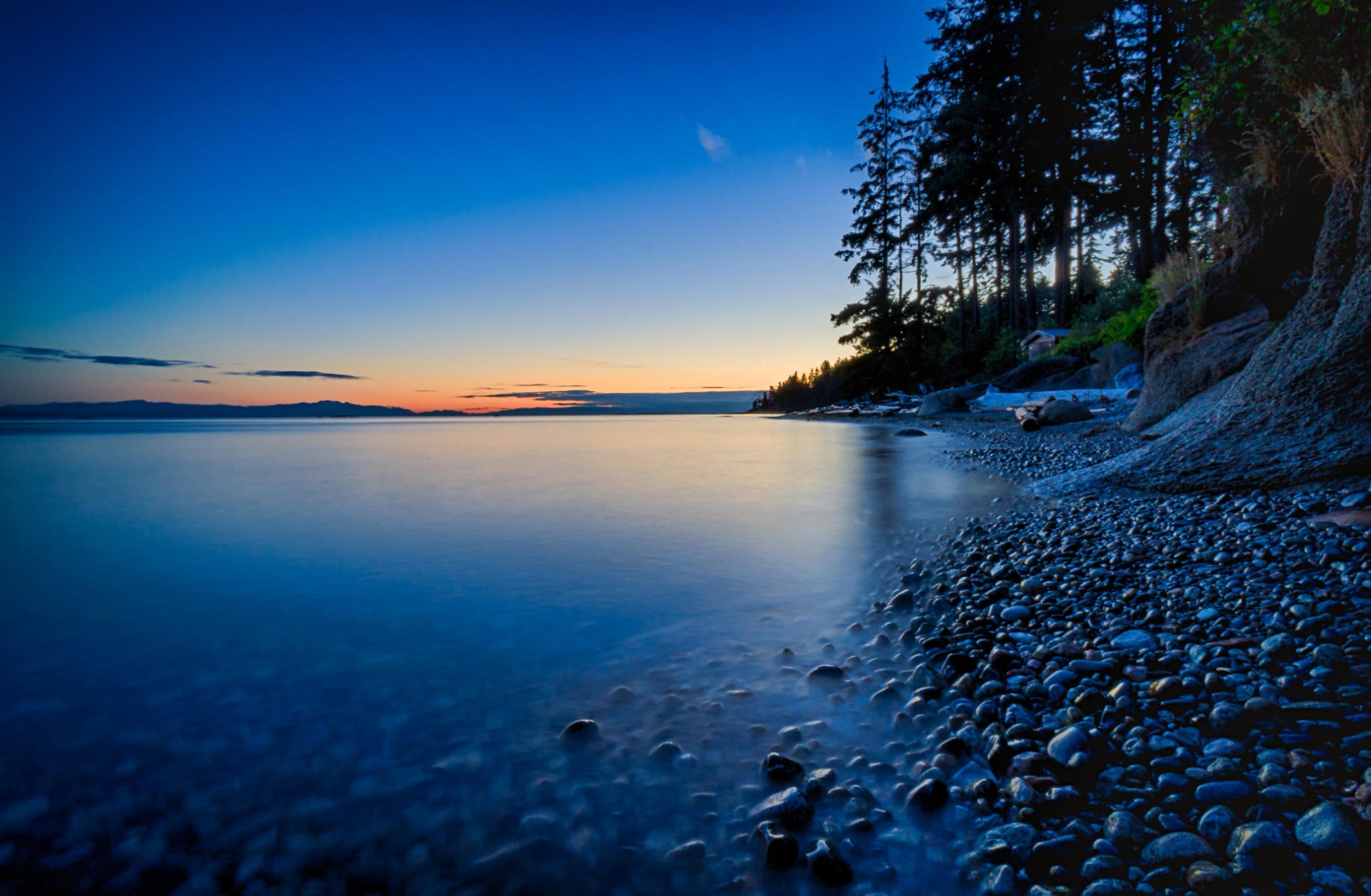
But all those ups and downs ensure the views keep coming. The trail remains beautifully varied as it weaves through majestic old-growth forests, skirts coastal beaches, and follows the banks of pristine freshwater streams and lakes. Given its temperate maritime location, this trail boasts a long, relatively snow-free hiking season. Summer brings the sunniest weather, but it rarely becomes unbearably hot or cold. This classic Salish Sea route delivers evergreen-clad coastal mountain and waterscape views for days. If you’re lucky, you’ll catch some of the most perfect hiking weather on the planet from late spring through autumn.
Only about 500 to 1,000 people complete the entire thru-hike each year, though several thousand more utilize its distinct sections for shorter backpacking trips and day hikes. Most end-to-end hikers take between 10 and 14 days to complete it.
This one is most definitely on my bucket list—and hopefully, sometime soon.
For more maps, hut updates, and planning resources, visit the official Sunshine Coast Trail website at sunshinecoasttrail.com.